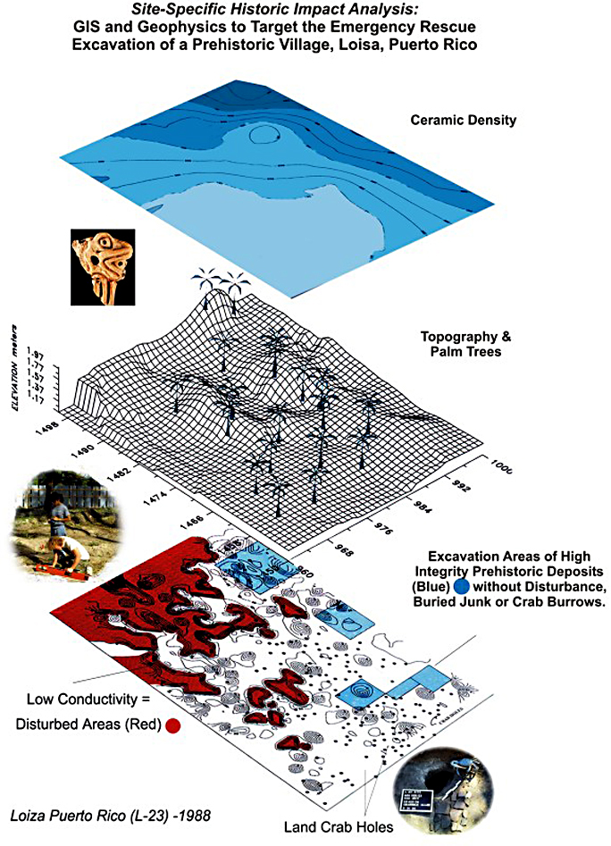
Early (1988) application of Geophysical survey and Historic GIS, or Historic Impact Analysis, to target only high priority areas of a disturbed prehistoric village site in the path of major USEPA-funded water reclamation project along the coast of Puerto Rico (see Grossman 1990, 2003).