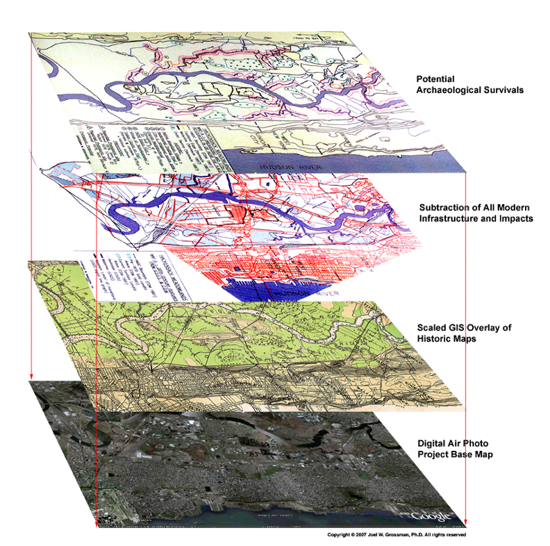
Figure 4 (Grossman 2007a): Historic Impact Analysis , or timme-based geospatial comparison, between two digital map layers illustrating potentially surviving prehistoric and historic cultural resources within the New Jersey Hackensack Meadowlands. The goal of Historic GIS is to define un-impacted areas that could contain potentially surviving prehistoric and historic cultural resources after subtracting modern impacts. In this case, the approach reduced the number of projet parcels in need of additonal investigation by ca . 80%. (Grossman 1992 and 1994, 1995, 1997, Grossman in Hunter Research 2006 USACE Meadowlands study.) See Grossman 2007a for discussion of these archaeological geospatial analytical strategies.
[Raritan Landing -1979] [Broad St. - 1984] [Fort Edward - 1986] [Loiza - 1987] [Superfund at West Point Foundry -1989-1995] [Early LIDAR in Albany-1999]
[Meadowlands GIS Plan - 1992 - 2006] [Mitigation Plan - Furnace Falls 2002 ] [Furnace Dalls - Color LIDAR -2004]
[Meadowlands GIS Plan - 1992 - 2006] [Mitigation Plan - Furnace Falls 2002 ] [Furnace Dalls - Color LIDAR -2004]